Virtual Hiking Tours
Hike with us and discover mineral resources!

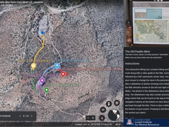
Old Pueblo Mine Hike
Who: Beginner hikers and those looking for an easy start before further exploring the Starr Pass trail!
Where: Hike starts and ends at the Richard E. Genser Starr Pass trailhead.
Hike Length: .7 miles (1.1 kilometers), 30 to 45 minutes if exploring.
Virtual Hike Length: 10 minutes.
Did you know that there was once a copper mine right next to the Richard E. Genser Starr Pass trailhead? You can even see it from the golf course!
Join us from the comfort of your home on this virtual hiking tour, or hike along with us using your smart device to enrich your experience.
The tour will take you on a journey around the Old Pueblo Mine. You will discover what the miners were looking for, what rocks they found, the history of the mine, and why the mine is in the Tucson Mountains.
The virtual hike will take you through a series of stops, each with their own description and 360 panoramic photo to explore. The stops are connected by hiking sections that are clearly marked on Google Earth and accompanied by narrated hiking videos. Hikers young and old can also try their hand at BINGO by downloading the Old Pueblo Bingo PDF and searching for the animals, plants, objects, and rocks listed on card.
The Old Pueblo Mine virtual hiking tour uses Google Earth Web and is most easily viewed with the free Google Earth app for smart devices or via the most recent version of the Chrome web browser (other browsers may work if they support WebGL).
If you will be hiking in person, please review the Tucson Mountain Park Rules and Hours.

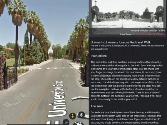
University of Arizona Historic Rock Wall Hike
Who: Beginner hikers and those looking to explore the UArizona Campus.
Where: Hike starts and ends at the University of Arizona Main Gate.
Hike Length: 1.65 miles (2.64 kilometers), 50 to 80 minutes if exploring.
Virtual Hike Length: 10 to 15 minutes.
It's 1916. You are the student body president. Can you think of a way for your class to leave a legacy behind while, at the same time, keeping cows from wandering onto the University campus?
But where are you going to get the rock?
Join us from the comfort of your home on this virtual hiking tour, or hike along with us using your smart device to enrich your experience.
The tour will take you on a hike of historical discovery around the historic University of Arizona rock perimeter wall. You will see historic photos of campus,360 degree views of how the campus looks today, hiking video to guide your journey, and fun facts about the historic rock wall.
The virtual hike will take you through a series of stops, each with their own description and 360 panoramic photo to explore. The stops are connected by hiking videos that automatically take you to the next stop on the tour . Hikers young and old can also try their hand at BINGO by downloading the Rock Wall Bingo PDF and searching for the animals, plants, objects, and rocks listed on card.
The UArizona Igneous Rock Wall virtual hiking tour uses Google Earth Web and is most easily viewed with the free Google Earth app for smart devices or via the most recent version of the Chrome web browser (other browsers may work if they support WebGL).
If you will be hiking along with us, please review these sun safety tips and remember to stay hydrated!
